


 Druckversion
 Wegbeschreibung
Navigationshilfe
Hinweis:In den letzten Jahren haben sich die Navigationsgeräte stark verbessert. Die unten stehende Beschreibung ist wahrscheinlich nicht mehr notwendig und Sie können Camping Tiveden oder die Adresse direkt auf Ihrem Smartphone eingeben.
Älterer Text:
Weil Camping Tiveden ganz abgelegen liegt, kennen die meisten Navigationsgeräte die Namen der Dörfer und Strassen nicht. Je nach Navi-Gerät können Sie unsere Adresse so angeben:
Koordinaten:
Bitte beachten Sie, dass je nach Gerät können das Format wechseln:
| Grad: | N +58.7986° | E +14.5391° |
| Minuten: | N +58° 47.92' | E +14° 32.35' |
| Sekunden: | N +58° 47' 54" | E +14° 32' 20" |
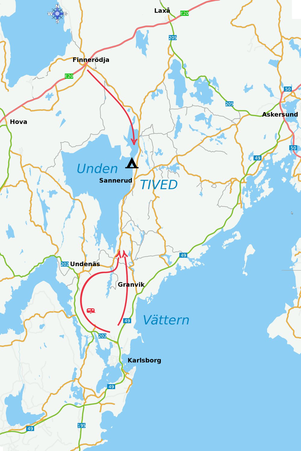
Vom Norden, Westen und Osten:
Ziel angeben: Undenäs über Finnerödja, auf der E20.
Fahren Sie durch Finnerödja, Richtung Undenäs. Halten Sie 21 km vor Undenäs. Der Campingplatz befindet sich auf Ihrer rechten Seite.
Wenn sie das Dörfchen Sannerud erreichen, sind Sie 3 km zu weit gefahren.
Vom Süden:
Ziel angeben: Finnerödja über Mitte Undenäs.
Fahren Sie durch Undenäs, Richtung Finnerödja. Halten Sie 18 Km vor Finnerödja. Der Campingplatz befindet sich dann auf Ihrer linken Seite.